Ma-ubin District (Ma-ubin District)
Maubin District (မအူပင်ခရိုင် ) is a district in Ayeyarwady Division, Myanmar. It consists of 39 wards, 235 village groups and 1642 villages organized into four townships - Maubin, Pantanaw, Nyaungdon and Danuphyu. The district lies on a flat plain, cut by many streams, which is 1,362 feet above sea level. It has an area of 1651.49 square miles (1,056,952 acres). The majority of the population are Burmese and Kayin nationals.
Four bridges provide access between different areas: Maubin Bridge in Taloatlatt, Khattiya Bridge near Latyargyi and Bokanbay, Pantanaw River-Crossing Bridge on Bayintnaung Street in Pantanaw, and Bomyathtun Bridge, which crosses the Ayeyarwaddy River from Taungtan to the vicinity of Kyeinpinsae. The grave of Commander in Chief Maharbandoola is located in the district, as is Danuphyu Fort, which was famous in the first Anglo Myanmar war and afterwards destroyed by a flood.
Four bridges provide access between different areas: Maubin Bridge in Taloatlatt, Khattiya Bridge near Latyargyi and Bokanbay, Pantanaw River-Crossing Bridge on Bayintnaung Street in Pantanaw, and Bomyathtun Bridge, which crosses the Ayeyarwaddy River from Taungtan to the vicinity of Kyeinpinsae. The grave of Commander in Chief Maharbandoola is located in the district, as is Danuphyu Fort, which was famous in the first Anglo Myanmar war and afterwards destroyed by a flood.
Map - Ma-ubin District (Ma-ubin District)
Map


Country - Burma
 |
 |
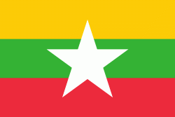
| Flag of Myanmar | |
Early civilisations in the area included the Tibeto-Burman-speaking Pyu city-states in Upper Myanmar and the Mon kingdoms in Lower Myanmar. In the 9th century, the Bamar people entered the upper Irrawaddy valley, and following the establishment of the Pagan Kingdom in the 1050s, the Burmese language, culture, and Theravada Buddhism slowly became dominant in the country. The Pagan Kingdom fell to Mongol invasions, and several warring states emerged. In the 16th century, reunified by the Taungoo dynasty, the country became the largest empire in the history of Southeast Asia for a short period.
Currency / Language
| ISO | Currency | Symbol | Significant figures |
|---|---|---|---|
| MMK | Myanmar kyat | Ks | 2 |
| ISO | Language |
|---|---|
| MY | Burmese language |